High Altitude Aerial Photography
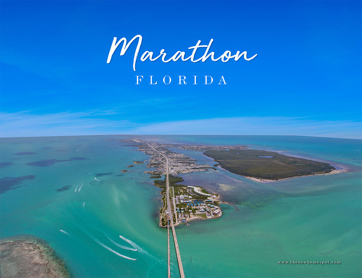
Sometimes an aerial photography project requires more altitude than our drones are legally allowed to fly. For instance, in class G airspace, the FAA stipulates that we fly no higher than 400’ above ground level. This means that sometimes we simply can’t fly high enough to show large communities in a single photo. In other words, once the subject property gets over 20 acres, it is time to evaluate the shape of the property to see if the drone can handle it or if manned aircraft is the better solution. Another time we use manned aircraft is for class D airspace in Key West and off shore islands over a 1/2 mile from land.
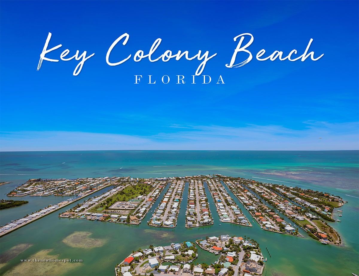
Case in point, Lisa Baez at thenewhomespot needed community photos around Marathon, one of which was the entire city! At nearly 10 square miles, a photo of Marathon in its entirety is way beyond the capability of a drone. Fortunately our good friend Justin at Ultimate Heli Tours ultimate-helitours is always making the rounds in Marathon well above 400 feet. We hear him on the aircraft band radio nearly every time we operate in the Middle Keys, giving us the heads up on where he is headed so we can stay out of his way. He is an awesome pilot flying a Robinson R44 Helicopter with up to 3 guests typically looking for wildlife and other local sites like Pigeon Key, Sombrero Beach, Seven Mile Bridge and Sombrero Lighthouse.
This time I was up there with him! Two cameras in hand with shutter speeds in the stratosphere, we needed a little over 1,000 feet to get this shot of Marathon. Despite the hazy conditions, the Canon DSLRs were able to record enough data for serviceable images that turned out pretty great after processing. In addition to the photos, it was also a lot of fun and a short escape from the hot summer heat down here in the Florida Keys. Check them out here:


